
Skip to main content Skip to footer

Use deep learning for vegetation risk mitigation

Overview

Deep learning models automate image and data analytics and empower water and electric utilities with a proactive system for vegetation management. It also boosts grid reliability by mitigating hazards and accelerating disaster response.

Infosys Utilities creates a data ecosystem to leverage remote sensing, machine learning (ML) and automation for vegetation management. We develop artificial intelligence (AI) systems to assess vegetation growth and detect encroachment based on drone and satellite imagery, 3D Light Detection and Ranging (LiDAR) maps, and Geographic Information System (GIS) data.

Our domain experts use growth rate modeling to forecast vegetation height and canopy cover, based on tree species, soil conditions, and environmental parameters. These insights help utilities make informed decisions to manage invasive trees and bushes.

Our data specialists align ML models with GIS databases and asset maintenance workflows. This ensures interoperability between datasets in heterogeneous formats, scale and schemas. Further, it creates a loop for continuous update of weather, vegetation and asset conditions.

Infosys AI-powered vegetation management solution uses risk scoring to recommend frequency of pruning. Significantly, integration with ERP systems automates work order and resources assignment to prevent vegetation interference.

Infosys capabilities:

Infosys Topaz AI suite minimizes engineering effort to develop plugins and APIs for integrating AI models

Elimination of positional and classification errors in GIS and sensor data ensures accurate ML output

Feature engineering techniques generate ML-ready datasets
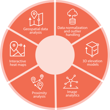
Our AI-powered vegetation management solution safeguards transmission and distribution infrastructure ensures crew and public safety, and mitigates environmental risk.

Talk to our experts

Mitigate Vegetation Risk with AI-Powered Insights

  • Automated systems to maintain minimum vegetation clearance distance (MVCD) prevents flashover, and ensures compliance with local, asset-specific clearance guidelines.
  • Heat maps and fire threat maps help identify line clearance conflicts as well as high-risk power circuits, enabling preventive intervention and accelerating disaster recovery.
  • Risk-based vegetation trimming schedules ensure efficient maintenance planning and field crew dispatch.
Line

Challenges & Solutions

The ability to predict vegetation outgrowth, identify branches breaching safety thresholds, and detect windsnap in near-real time mitigate hazards and power interruption.

Smart solutions to monitor utility assets and vegetation across T&D infrastructure minimize human intervention and rationalize per-mile cost of vegetation management.

Machine learning algorithms parse 3D LiDAR maps as well as spatial and temporal data from diverse sources and identify high-risk corridors.

Resource Center

Brochure

Infosys solution for vegetation management

Watch
Analyst report

Prysmian Group implements robotic solution for overhead conductor management

Read more
Point of view

Impact of 5G on energy utilities

Download
Point of view

The AI shift: Reinventing field service

Download

Request for services

Find out more about how we can help your organization navigate its next. Let us know your areas of interest so that we can serve you better.


All the fields marked with * are required

You must read and agree to the Privacy Statement before submitting
Please fill all required fields

Thank you for connecting with us. We will respond to you shortly.